7-Days Kilimanjaro Machame Route

A scenic journey to Kilimanjaro’s summit

Loading available options...

Overview

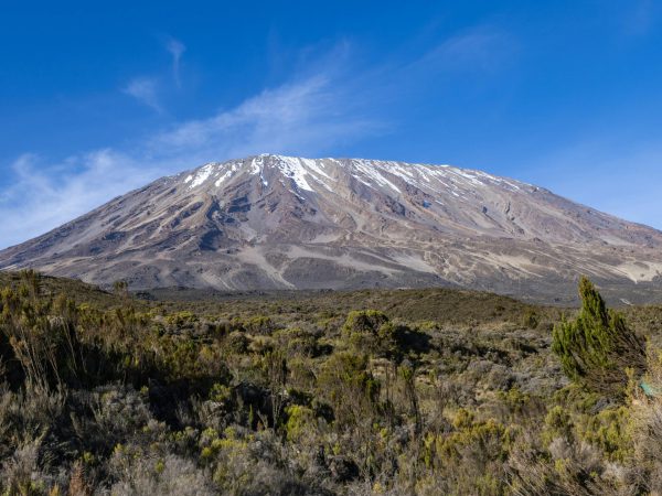
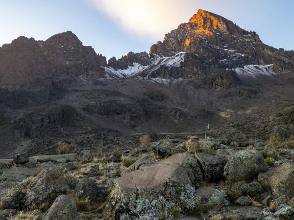
    The Machame Route, famously known as the “Whiskey Route,” is one of the most scenic and adventurous paths to summit Mount Kilimanjaro. Starting from the lush Machame Gate, climbers trek through dense rainforest, spotting exotic flora and occasionally wildlife like monkeys and birds. As the trail ascends, the landscape transforms into moorlands dotted with giant lobelias and groundsels, offering dramatic views of the mountain and surrounding valleys. Higher up, trekkers traverse alpine deserts and rocky terrains, facing steep slopes that challenge endurance but increase acclimatization for a successful summit. With a typical itinerary of 6–7 days, the Machame Route combines diverse ecosystems, breathtaking scenery, and a gradual climb that balances challenge and safety, making it a favorite for adventurers seeking both natural beauty and a high probability of reaching Uhuru Peak.
    Read more

    Highlights

    • One of the most scenic and popular routes on Mount Kilimanjaro, known for dramatic landscapes
    • Excellent acclimatization profile with a “climb high, sleep low” approach for better summit success
    • Trek through diverse ecosystems including rainforest, moorland, alpine desert, and arctic summit zone
    • Stunning viewpoints such as Shira Plateau, Lava Tower, and Barranco Wall
    • Challenging but rewarding route with a true adventure-style trekking experience
    • High chance of successful summit at Uhuru Peak, the roof of Africa
    • Descent through the scenic Mweka route for a complete mountain experience

    Includes/Excludes

    • Park fees (National Park entry, camping/hut fees, rescue fees).
    • Professional guides and porters (usually one guide per 2–3 trekkers).
    • Accommodation on the trek (tents at campsites).
    • Meals (breakfast, lunch, dinner) during trekking days.
    • Hot drinks and snacks during trekking.
    • Camping equipment (tents, dining tents, chairs, tables).
    • Emergency evacuation support if needed.
    • Transportation from your hotel or Arusha to the trailhead and back.
    • Tips for guides and porters.
    • Personal trekking gear (sleeping bags, trekking poles, jackets).
    • Travel insurance and medical evacuation coverage.
    • Flights to Tanzania.
    • Beverages outside provided meals, such as bottled water or soda.
    • Visa fees for entry into Tanzania.

    Itinerary

    Day 1: Drive to Kilimanjaro National Park Machame Gate, Hike to Machame Camp

    Drive from Moshi to the Mount Kilimanjaro National Park Gate takes about 45 minutes but driving from Arusha it will take almost 2 hours. The journey passes through the village of Machame which is located on the lower slopes of the mountain.

    We depart the park gate and walk through the rain forest on a winding trail up a ridge. At lower elevations the trail can be muddy and slippery. Gaiters and trekking poles are a good idea here. We continue a short distance until we reach the Machame Camp.


    Elevation: 2835m

    Distance: 11km/7mi

    Hiking Time: 5-6 hours

    Habitat: Moorland.

    Meals: B, L, D

    Budget Camping: Machame Camp

    Day 2: Hike Machame Camp to Shira Camp

    After breakfast we leave the glades of the rain forest and continue on an ascending path, crossing the valley along a steep rocky ridge. The route now turns west onto a river gorge until we arrive at the Shira Cave campsite.


    Elevation: 3750m


    Distance: 5km/3mi

    Walking Time: 4-5 hours

    Habitat: Moorland

    Meals: B, L, D

    Budget Lodging: Shira Camp

    Day 3: Hike Shira Cave Camp to Lava Tower then Barranco Camp

    From the Shirer Plateau we continue to the east up a ridge, passing the junction towards the peak of Kibo. As we continue, our direction changes to the South East towards the Lava Tower, called the “Shark’s Tooth” (elev 4650m/15,250ft). Shortly after the tower we come to the second junction which goes to the Arrow Glacier. We now continue down to the Barranco Camp. Although you end the day around the same elevation as when you began, this day is very important for acclimatization and will help your body to prepare for the day that you will be summiting.


    Elevation: 3900m

    Distance: 10km/6mi

    Walking Time: 5-6 hours

    Habitat: Semi-desert

    Meals: B, L, D

    Budget Lodging: Barranco Camp

    Day 4: Barranco Camp to Karanga Camp

    After breakfast, we leave Barranco and continue on a steep ridge up the Barranco Wall to the Karanga Valley and the junction which connects with the Mweka Trail.

    Elevation: 4000m/13,000ft to 4050m/13,250ft
    Distance: 5km/3mi
    Climbing Time: 3-4 hours
    Habitat: Alpine Desert
    Meals: Breakfast, Lunch and Dinner

    Day 5: Karanga Camp to Barafu Camp

    We continue up to the Barafu Camp. You have completed the South Circuit, which offers views of the summit from many different angles. Here we make camp, rest, enjoy dinner, and prepare for the summit day.

    Elevation: 4050m/13,250ft to 4700m/15,350ft
    Distance: 4km/2mi
    Climbing Time: 3-4 hours
    Habitat: Alpine Desert
    Meals: Breakfast, Lunch and Dinner

    Day 6: Barafu Camp to Summit, down to Mweka Camp

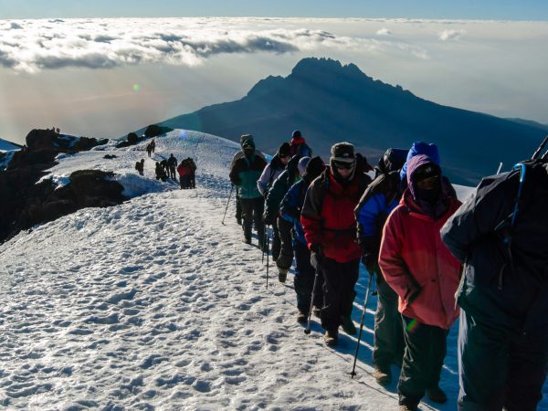
    Very early in the morning (midnight to 2 am), we continue our way to the summit between the Rebmann and Ratzel glaciers. You head in a northwesterly direction and ascend through heavy scree towards Stella Point on the crater rim. This is the most mentally and physically challenging portion of the trek. At Stella Point you will stop for a short rest and will be rewarded with the most magnificent sunrise you are ever likely to see. Faster hikers may view the sunrise from the summit-Kilimanjaro Machame Route 7-Days.

    From Stella Point, you may encounter snow all the way on your 1-hour ascent to the summit. Once at Uhuru Peak you have reached the highest point on Mount Kilimanjaro a Roof of Africa and the continent of Africa as well.

    From the summit we begin our descent by continuing straight down to the Mweka Camp, stopping at Barafu for lunch. You may want gaiters and trekking poles for the loose gravel going down. We arrive at Mweka Camp and enjoy our last evening on the mountain.

    Elevation: 3100 m

    Distance: 8 km

    Descending time: 2 to 3 hours.

    Habitat: Moorland Zone

    Meals: B, L, D

    Budget Campsite: Mweka Camp
    Day 7: Decend Mweka Camp to Mweka Gate, drive to Arusha

    After breakfast we continue the descent down to the Mweka Park Gate to receive your summit certificates. At lower elevations, it can be wet and muddy. Gaiters and trekking poles will help. Shorts and t-shirts will probably be plenty to wear (keep rain gear and warmer clothing handy).

    From the gate, continue another hour to Mweka Village. A vehicle will meet you at Mweka village to drive you back to your hotel in Arusha. Don’t forget to tip your guides and porters.

    Elevation: 1640m

    Distance: 10km/6mi

    Hiking Time: 3-4 hours

    Habitat: Forest

    Meals: BAt Kijiji village.

    You might also like...