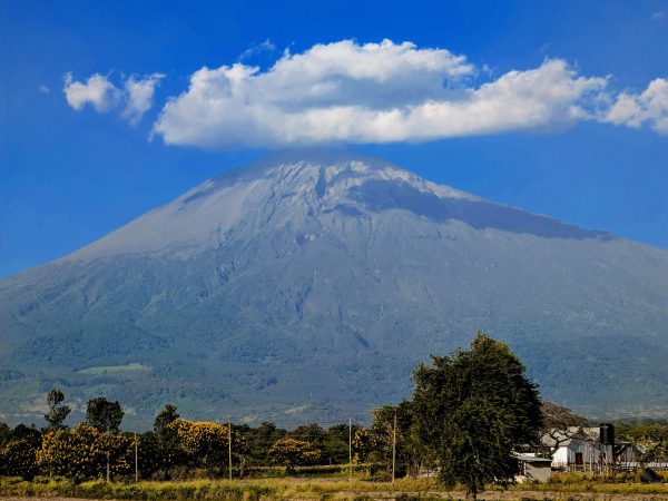
4-Day Mount Meru Sunrise Summit Trek
Rising above Arusha, Mount Meru offers a scenic...
Experience panoramic views on the less-traveled route
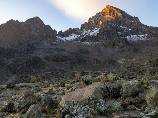
The Northern Circuit Route is the longest and least crowded path to Mount Kilimanjaro, offering a full 360-degree view of the mountain. Starting from the lush forested slopes, trekkers gradually ascend through moorlands, alpine deserts, and high-altitude landscapes, allowing excellent acclimatization. Along the way, climbers enjoy spectacular panoramas, scenic ridges, and the chance to experience the mountain’s diverse ecosystems in relative solitude. The route circles the entire mountain before reaching the summit, giving adventurers both a challenging climb and a rewarding, less-traveled experience that maximizes their chances of success.
Leave in the morning from hotel to Lemosho Gate were gate is located. The start of trail 2100m trek winds up through the lush forest zone on to the lower slopes of the northern side, going to Shira Plateau. Overnight at Mti Mkubwa 2650m, 3 to 4 hours.
Elevation: 1830m/6000ft to 2650m/8700ft
Distance: 7km
Hiking Time: 3-4 hours
Habitat: Montane Forest
After breakfast, you will follow a thin trail through the rainforest before leaving the green area behind heading into moorland. Erica and Lobelia plants will start to take over the landscape. After about 4-5 hours you will reach Shira One Camp where you will have your evening meal and overnight stay.
Elevation: 2650m/8700ft to 3500m/11,500ft
Distance: 8km/5mi
Hiking Time: 4-5 hours
Habitat: Moorland
After breakfast, a gentle hike across the plateau leads to Shira 2 camp on moorland meadows by a stream. A variety of hikes are available on the Plateau, making this an excellent acclimatization day.
Elevation: 3500m/11,500ft to 3850m/12,600ft
Distance: 8km/5mi
Hiking Time: 4-5 hours
Habitat: Moorland
Meals: B, L, D
Budget Camping: Shira 2 Camp
Day four is a long trek heading east which passes through the ‘Garden of the Senecios’ and then enters the high alpine desert zone. The morning is spent trekking up to Lava Tower and the iconic Shark’s Tooth rock formation at 4,600 meters, where you will have lunch. After lunch, you will join the northern circuit heading down to Moir Camp at 4,200 meters (see map above). This is an important day in your trek as you will get to experience high altitude and then sleep low, which is good for the acclimatization process.
Elevation: SHIRA CAMP 2 (3850M) to MOIR CAMP (4200M)
Distance covered: 14km / 8mi
Approx. time taken: 5-7 hours
Day five involves a moderately steep climb out of Moir Valley. Trekkers can take a small detour here to climb the summit of Little Lent Hill at 4,375 meters before returning to the Northern Circuit trail. From here the route follows a series of inclines and declines, skirting around the northern slopes of Kibo to Buffalo Camp (4,020 meters). The trek gives great vistas out across the plains that lie north of Kilimanjaro and stretch out to the Kenyan / Tanzanian border. You will arrive at Buffalo Camp just after midday, where you will have lunch and have time to rest after a long day hiking.
Elevation: Moir Camp (4200 M) to Buffalo Camp (4020 M)
Distance covered: 12km /7Mil
Approx. time taken: 5 – 7 hours
Day six starts with a climb up he Buffalo ridge and down into Porfu Camp where lunch is usually served. The route then continues east around the northern slopes to the Rongai Third Cave at 3,800 meters. The trek is shorter than the day before and by now you should be feeling well acclimatised to the altitude. You will arrive at the Third Cave just around mid-afternoon.
Elevation: Buffalo Camp (4020 M) to Rongai Third Cave (3800 M)
Distance covered: 8km / 5mi
Approx. time taken: 5 -7 hours
Day seven involves a steady incline up and over the Saddle which sits between the peaks of Kibo and Mawenzi Peak. Trekkers then continue walking south-west up to School Hut (4,800 meters). After arriving at School Hut you will be served an early dinner and then you should get some shut-eye as you will be awoken before midnight to start your summit attempt. Remember to prepare all your gear, including warm clothes, insulated water bottles, snacks, headlamp and camera before going to bed.
Elevation: Third Cave Camp (3800 M) to School Hut (4800 M)
Distance covered: 15km / 8miles
Approx. time taken: 5 hours
Trekking time: 6-8 hours ascent and then 4-6 hour descent
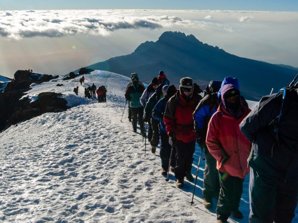
You will be awoken around 11:30 with hot tea and biscuits and will then begin the steep incline up the slopes of Kibo under the cover of darkness. Your first check-point is Hans Meyer Cave where you will take a short break. The climb steepens as you approach Gilman’s Point (5,681 meters), which will be around 5-6 hours after departing School Hut. Take a moment to enjoy the approaching dawn and incredible view out and across to Mawenzi Peak, but remember you still have 2 hours trekking to reach Uhuru Peak so dig deep for the energy. The slope flattens as you head west around the crater rim and you should arrive at the summit at or just after sunrise. Your stay here will be brief so get as many pictures as you can of the incredible views and surrounding glaciers. You will then retrace your steps back around the crater rim to Stella Point (5,739 meters) where you will turn south and head down the heavily screed slopes of Kibo to Barafu Camp (4,680 meters). Most trekkers take a short break here before continuing down to Millennium Camp (3,950 meters) for your final night on the mountain. In total, you will be trekking for 14-16 hours on day eight so it is important to pace yourself, remain hydrated and keep your blood sugar levels up. Note: some tour operators return via Gilman’s Point to Horombo Hut using the Marangu Route
Elevation: SCHOOL HUT (4,800 METERS) TO UHURU PEAK (5,895 METERS) AND THEN ONTO MILLENNIUM CAMP (3,950 METERS)
Distance: ~6km / 3.5 miles ascent and 10.5km / 6 mile descent
The final day is a short hike through the dense montane rainforest from Millennium Camp (3,950 meters) to Mweka Gate (1,640 meters). At the gate you will need to sign-out with the authorities, who will also provide you with your official certificate – a green certificate for those who made it to Gilman’s Point and a gold certificate for those who reached Uhuru Peak. It is customary to give your guide and porter tips before being driven back to your hotel in Arusha.
Elevation : Millennium Camp (3,950 meters) to Mweka Gate (1,640 meters)
Distance: ~10km / 6.5 miles
Trekking time: 4-5 hours
Have a question before booking? Message us to learn more.
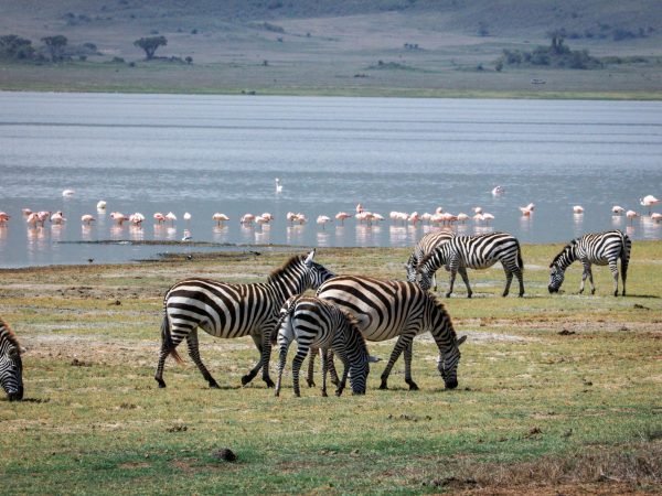
A romantic 5-day Tanzania honeymoon safari featuring breathtaking...